What is Laser Level in Surveying and How Does it Work? – A Complete Guide

Do you want to ensure your construction project is accurate and perfectly level? Then laser levels in surveying could be the answer you’ve been looking for. With the technological advancements of laser level devices in recent years, surveying has become more precise and efficient. The use of laser levels minimizes human error, reduces surveying time, and improves accuracy.
They are a useful tool for determining elevations and measuring distances, as well as being a more compact and portable option than older surveying equipment. In this blog, we will explore the benefits of using laser levels in surveying and how they have revolutionized the industry.
What is a Laser Level?
If you’re new to the world of surveying, you might be wondering, “what is a laser level?” Well, essentially, a laser level is a tool used to ensure a level surface on a site. It projects a laser beam that can be picked up by a detector, allowing the user to measure the height and angle of the beam. This is particularly useful for measuring large distances or uneven surfaces, as the laser level provides a precise reading that eliminates the need for guesswork.
Additionally, because it’s a self-leveling tool, it can be set up quickly and easily, without the need for tedious adjustments. So, if you’re looking to increase your accuracy and efficiency on the job site, a laser level is a worthwhile investment to consider.
How it works
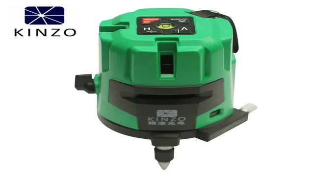
A laser level is a helpful tool that is commonly used in construction, carpentry, and DIY projects. Simply put, it emits a beam of light that can be used as a reference line for straight and level measurements. A laser level typically consists of a laser emitter and a leveling base.
The leveling base is fitted with a precision bubble vial or electronic sensor that helps to give accurate readings. When turned on, the laser beam comes straight out of the emitter and forms a level line that is projected around a space. This line can be used as a guide for a variety of tasks, from hanging pictures to installing tiles.
Laser levels are especially useful for large-scale projects and can save a significant amount of time compared to traditional measuring methods. The accuracy and ease of use of a laser level make it an essential tool for any construction or DIY project.

Types of Laser Levels used in Surveying
Laser levels are essential tools in surveying that help create accurate measurements without the need for traditional measuring methods. There are two main types of laser levels used in surveying: rotating laser levels and line laser levels. Rotating laser levels emit a rotating laser beam that creates a 360-degree horizontal plane, while line laser levels emit a straight line, either horizontally or vertically.
Both types of laser levels have their benefits and are used for different surveying tasks. Rotating laser levels are ideal for outdoor projects because they have a longer visible range and are better for creating level and grade lines. Line laser levels, on the other hand, are perfect for indoor tasks like installing ceiling tiles, aligning cabinets, or tiling floors.
With the help of these laser levels, surveyors can complete their projects quickly and efficiently while ensuring the highest level of accuracy.
Rotary Laser Level
When it comes to surveying, one tool that you can’t do without is a rotary laser level. This equipment enables you to project a level line around the room or outdoor space, ensuring that everything is aligned as intended. But did you know that there are different types of rotary laser levels available in the market? One of the most common types is the manual rotary laser level, which requires you to manually adjust the level as needed.
This is perfect for small-scale projects, such as those carried out by DIY enthusiasts. However, if you need to work on larger projects, then you might want to consider using a self-leveling rotary laser level. This type of laser level automatically adjusts its position as needed, making it more efficient and accurate.
Regardless of the type of rotary laser level you choose, always ensure that it’s of good quality to achieve the best outcomes for your surveying projects.
Line Laser Level
When it comes to surveying, lasers are an essential tool for achieving accurate measurements. One type of laser level commonly used is the line laser level. This tool emits a laser line across a desired surface, which can be used as a guide for measurements or alignments.
There are different types of line laser levels, including self-leveling and manual leveling. Self-leveling line laser levels automatically adjust to ensure a level line, while manual leveling requires the user to ensure the level manually. Both types are accurate and reliable and can be used in a variety of surveying applications.
Whether you need to install a new ceiling or align tiles on a floor, a line laser level will help you achieve precision and accuracy. So, if you’re looking for a dependable laser level for your next surveying project, a line laser level is definitely worth considering.
Dot Laser Level
If you’re a surveyor or a construction worker, you know the value of accurate measurements and leveling. That’s why laser levels have become an essential tool for your industry. A dot laser level is one of the most common types of laser levels used in surveying.
The dot laser level emits a single dot of laser light that can be used for a variety of applications, including leveling floors, aligning cabinets, installing tiles, and hanging pictures. Dot laser level technology has improved over the years and they now come in a range of different sizes and styles, making them highly versatile. They are easy to operate and provide accurate measurements, even over long distances.
Another benefit of the dot laser level is that they use less power than other types of laser levels, making them more efficient and more cost-effective. Overall, the dot laser level is a valuable tool for any surveyor or construction worker looking for a precise, reliable, and affordable way to level and measure.
Applications of Laser Levels in Surveying
Laser level in surveying is a must-have tool for accurate and efficient measurements. Its applications are vast, allowing surveyors to accomplish their tasks with precision and speed. From building layouts and excavations to road constructions and land development, a laser level proves to be handy in every job.
It can project a beam of laser light to provide a level line or plane, which is perfect for creating flat and even surfaces. It also helps surveyors to detect any changes in the elevation or slope, making adjustments easier. Additionally, laser levels are easy to use and most come with features like digital displays, laser detectors, and self-leveling capabilities.
All in all, a laser level is an innovative tool that has transformed the way surveying works. Its convenience, accuracy, and speed have made it a must-have for every surveyor’s toolkit.
Road Construction
Road construction projects require accuracy and precision in paving, grading, and excavation. For surveyors, laser levels are indispensable tools that help elevate the construction industry. The applications of laser levels in surveying have revolutionized the way road construction projects are executed.
These laser instruments can send a beam of light to a specific elevation, providing a level surface to work on. Surveyors can use them to establish the reference points, slope, vertical alignment, and horizontal alignment for the road. Moreover, they can also use them to perform excavation and grading activities efficiently.
By using laser levels, surveyors can save a significant amount of time, money, and resources by minimizing the need for manual labor and equipment. The accuracy, speed, and ease-of-use of laser levels make them an essential tool for any road construction project.
Building Construction
Among the various tools that a surveyor can use, laser levels have become increasingly popular in recent times. These tools utilize lasers to project a level line or a plumb line for measuring vertical orientation. Laser levels are particularly useful in building construction, as they make the work faster and more efficient.
Surveyors use these tools to create accurate layouts for buildings, check elevations, level foundations, set slopes, and walls. The laser levels have become more advanced and offer more features, such as self-leveling and remote control. The application of laser levels in building construction ensures that the structure is safe to use and visually appealing.
Overall, laser levels are a valuable tool in surveying and play a significant role in building construction, helping to improve accuracy, speed and workflow, and reducing the margin of error.
Advantages of Using Laser Levels in Surveying
When it comes to surveying, accuracy is essential, and laser levels are a game-changer in achieving it. Laser levels are an instrument used to project a level or plumb line that is useful in various surveying applications. They have gained popularity due to their high precision and ease of use compared to traditional surveying methods.
In addition, they help save time and labor costs, making them a preferred choice for construction and surveying professionals. Laser levels can project straight lines, angles, and plumb lines at long distances with high accuracy levels. They are ideal for indoor and outdoor applications, making them versatile tools for site surveying, grading, and leveling.
Overall, laser levels significantly improve the efficiency and productivity of surveying operations, providing accurate and reliable results.
Conclusion
In short, a laser level in surveying is like having a superpower that allows you to create perfectly straight lines, accurate measurements, and precise angles with just the push of a button. It’s a tool that has revolutionized the construction industry and made the lives of surveyors and builders so much easier. Now, whether you’re building a skyscraper or planting a garden bed, you can do it with confidence and efficiency thanks to the mighty laser level.
So, to all the surveyors out there, keep shining bright with your laser level and keep building the world we live in, one straight line at a time!”
FAQs
What is a laser level in surveying?
A laser level is a tool used in construction and surveying to create a level reference line or plane for construction projects.
What are the benefits of using a laser level in surveying?
Using a laser level helps to ensure accuracy and precision in construction projects, as well as save time and reduce mistakes.
How does a laser level work?
A laser level works by projecting a laser beam onto a surface to create a reference line or plane. The laser can be set to different levels and angles, depending on the desired outcome.
What types of laser levels are available for surveying?
There are several types of laser levels available for surveying, including rotary laser levels, line laser levels, and dot laser levels.
Can laser levels be used in outdoor surveying projects?
Yes, laser levels can be used in outdoor surveying projects, as long as they are designed for outdoor use and have sufficient power to project the laser beam over longer distances.
How do you calibrate a laser level for surveying?
Laser levels should be calibrated before use to ensure accuracy. Calibration typically involves leveling the laser and adjusting any settings as needed.
What safety precautions should be taken when using a laser level in surveying?
Safety precautions when using a laser level include wearing appropriate eye protection and ensuring that the laser is not pointed directly at anyone’s eyes. It’s also important to be aware of any potential hazards in the surrounding area.


